


10
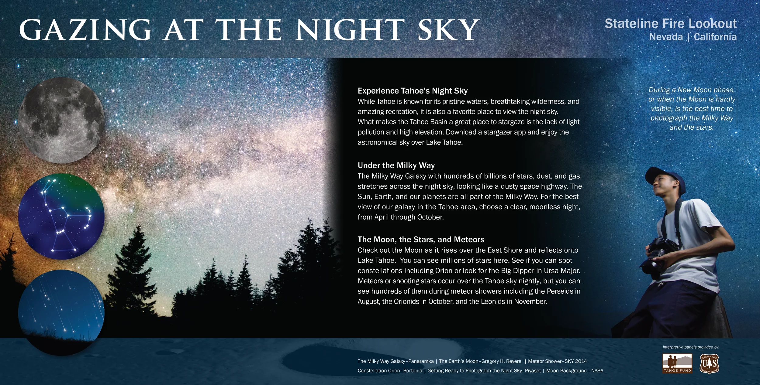
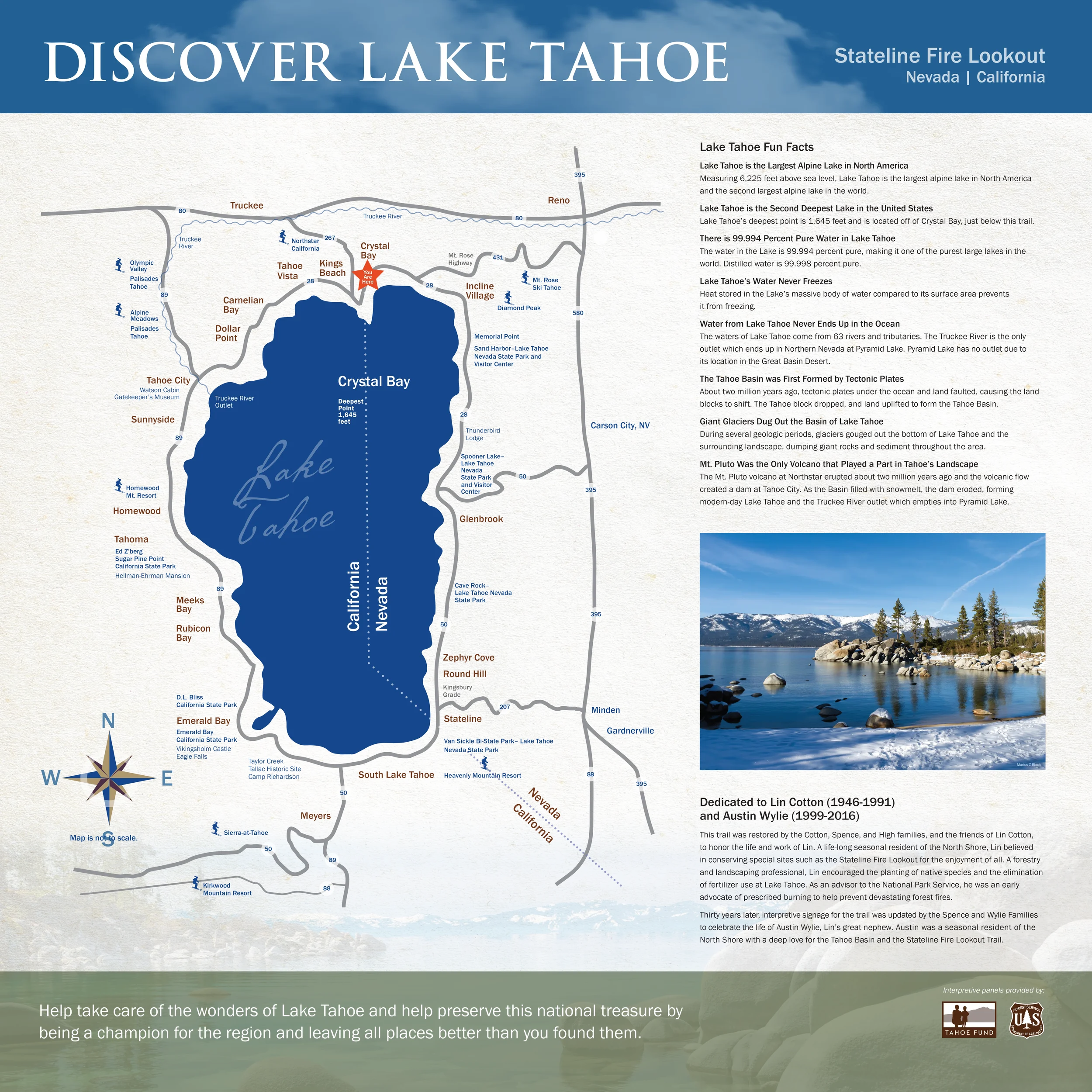
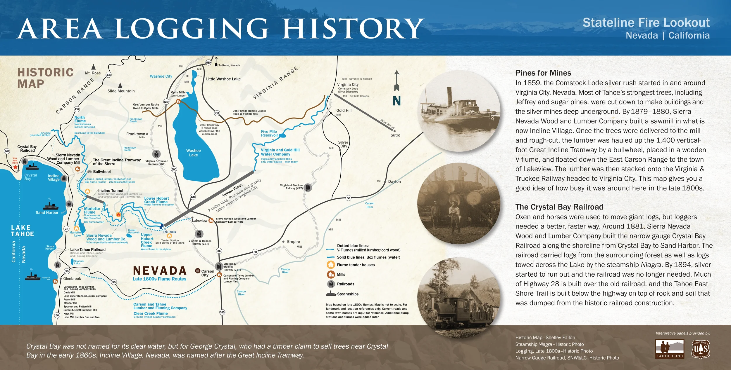
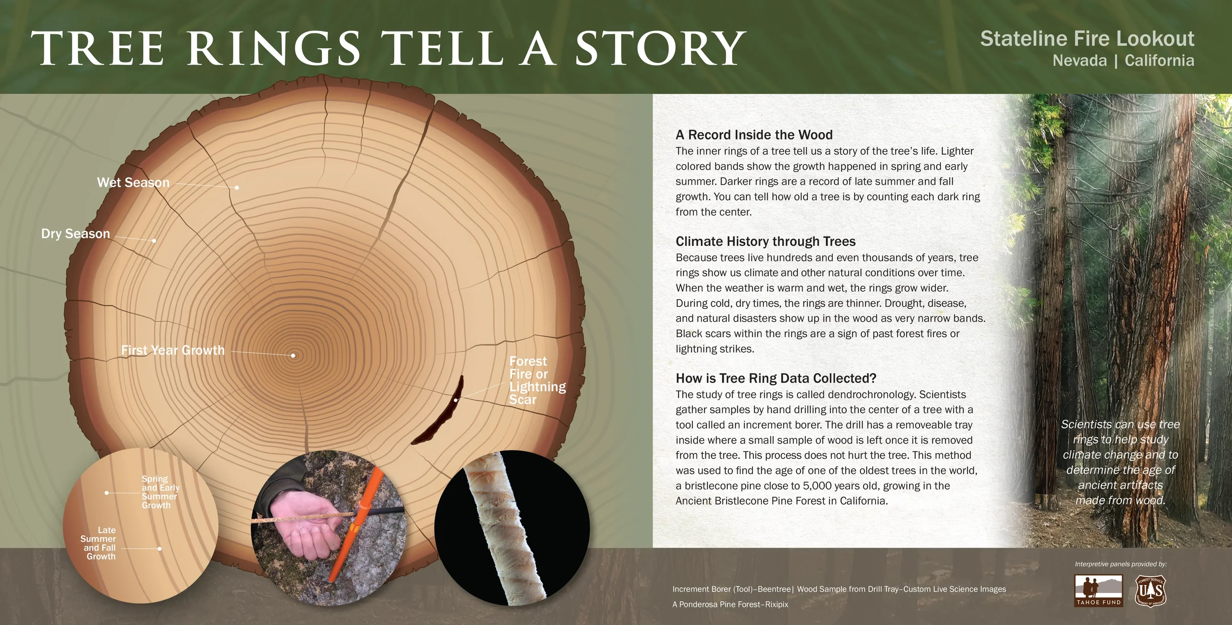
Stateline Lookout Trail – Crystal Bay, NV

22
Tahoe East Shore Trail, NV and CA

11
Lake Tahoe Nevada State Park – Memorial Point
5
Mammoth Lakes, CA Sherwin Trail
3
Mammoth Creek Parcel, CA
4
Carson City, NV – Mountain Street Trail
2
Clean Up the Lake–Environmental Dive Center Mammoth Lakes, CA
10
Wilbur D. May Arboretum & Botanical Garden, Reno, NV – 30 Interpretive Signs

4
Incline Flume Trail, NV
9
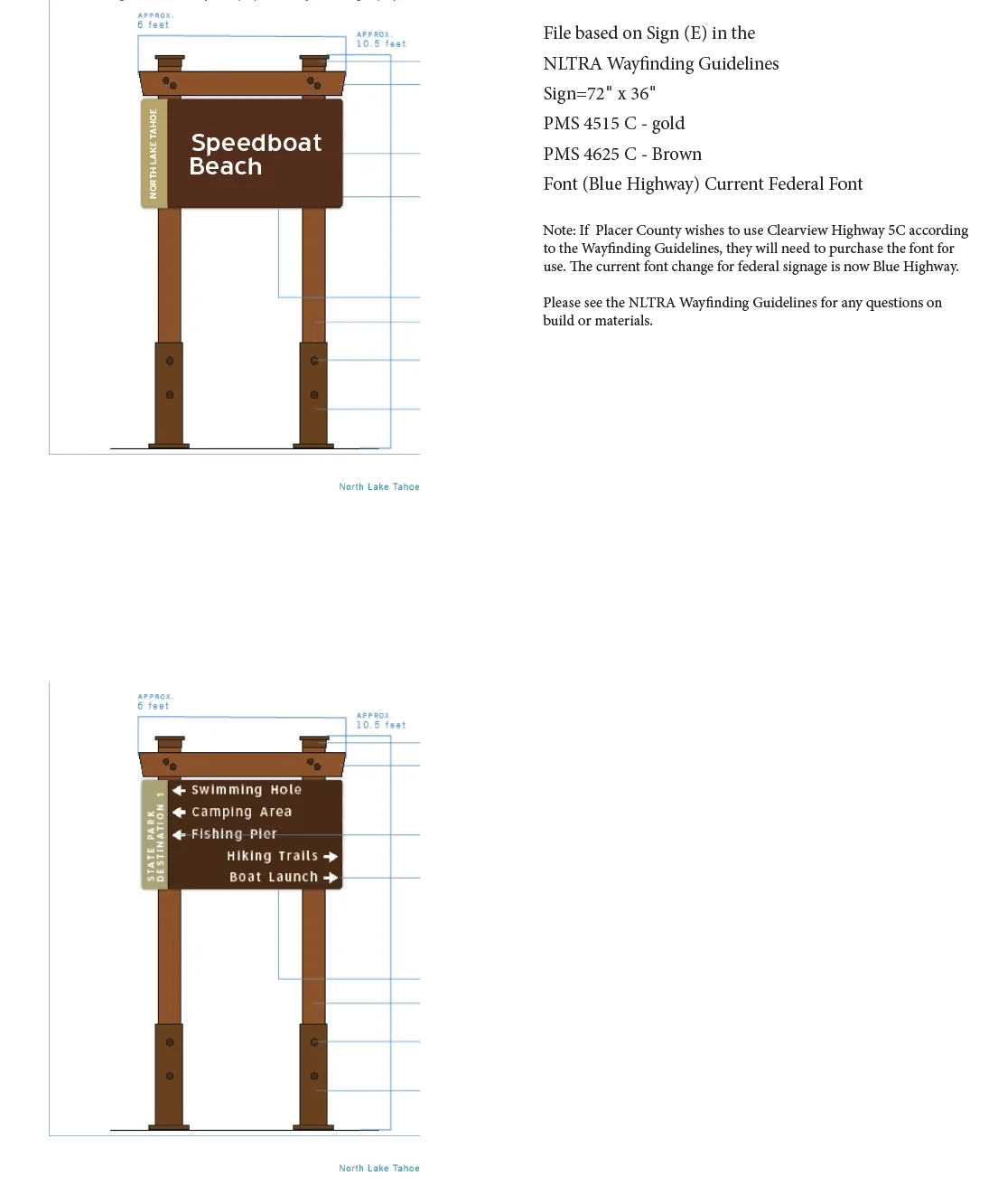
Speedboat Beach, CA

4
Washoe County Parks, NV

7
Nevada Department of Wildlife

1
Lake Tahoe Water Trail, NV / CA

7
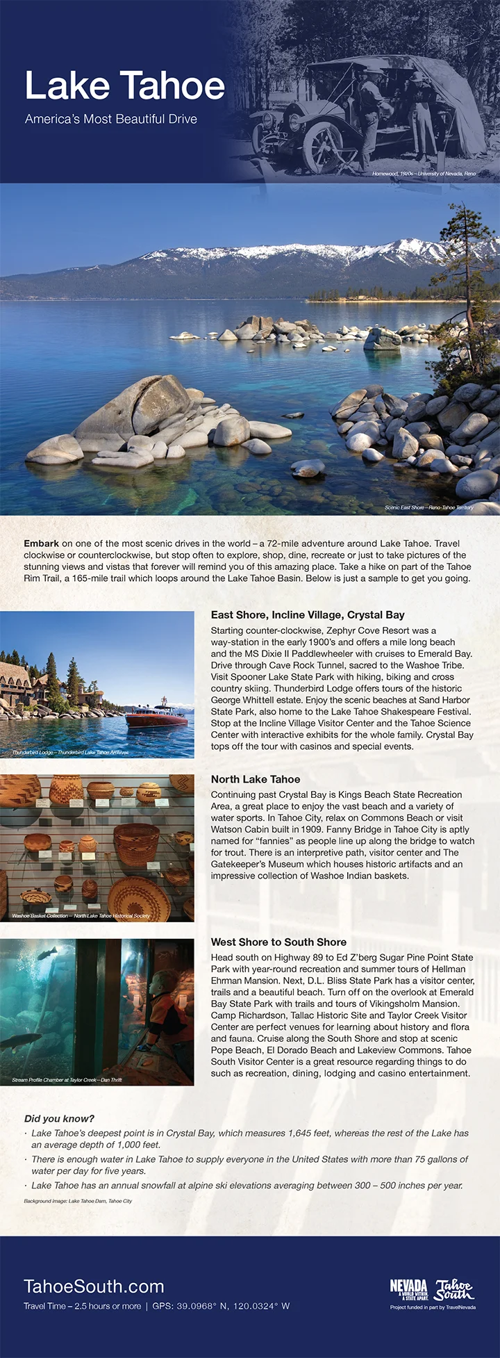
Lake Tahoe Visitors Authority Visitor Center, CA

10
North Lake Tahoe Resort Association Visitor Center, CA

3
Top of Slide Mt. | Washoe County, NV
16
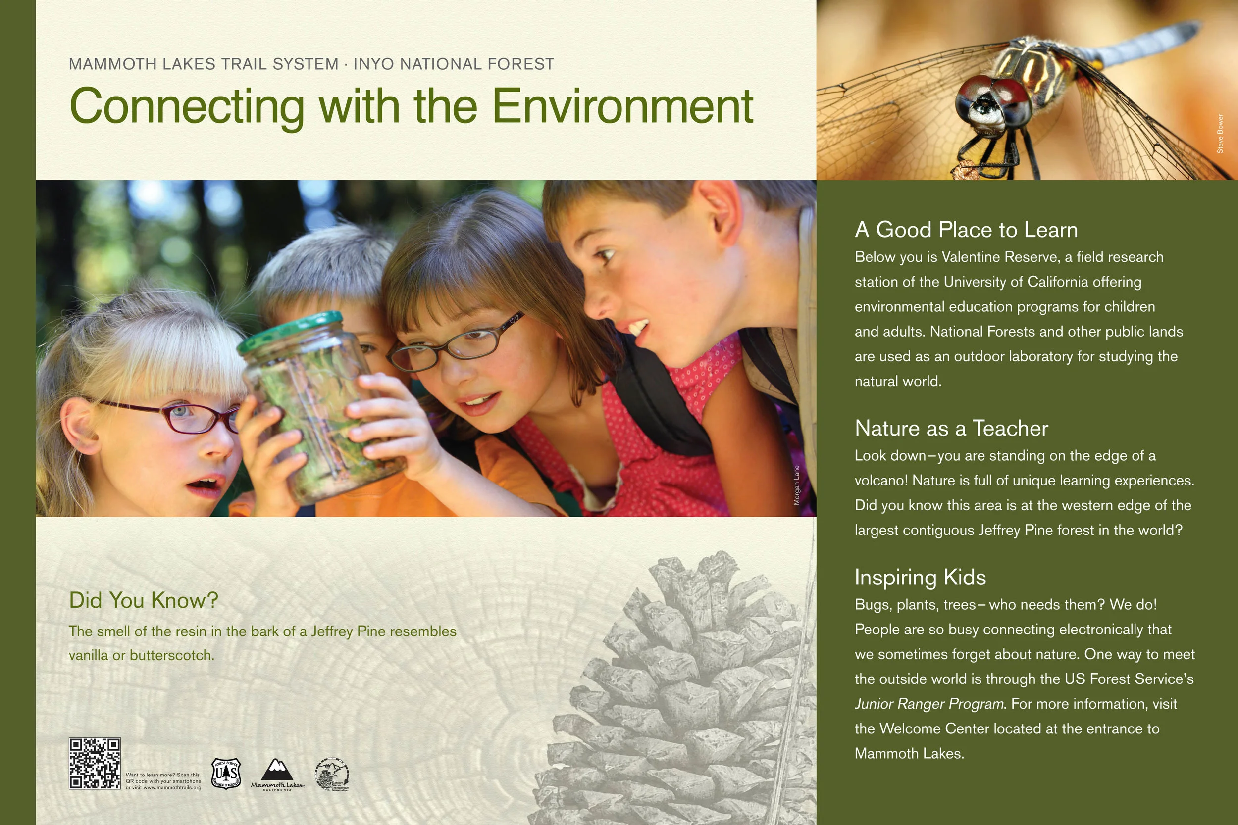
Mammoth Lakes U.S. Forest Service, CA

20
Bureau of Land Management, NV

3
History of Ranches in Reno, Washoe County, NV

8
Bowers Mansion–Washoe County, NV

8
Wilson Canyon, Yerington, NV

12
UC Davis, NV / CA

16
Fitzgerald Marine Reserve–San Mateo County, CA

1
Amphibians–U.S. Forest Service, NV / CA

1
Marlette Lake–Nevada State Parks

3
Caples Creek U.S. Forest Service, CA

1
Sundown Town, Reno, NV

1
Silver Lake, Reno, NV

8
Washoe County, NV | Earlier Work
